Cycling The Ibergeregg Pass
This ride took place on August 8th 2006. The weather was overcast and a short heavy downpour started as just I got on the train to head back home.
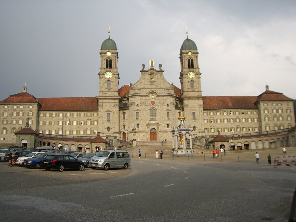
The picture below is of the Monastary in Einsiedeln.
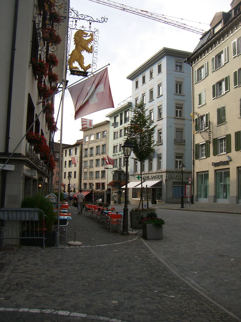
With my back facing the monastary the picture below is one of the streets of the old town.
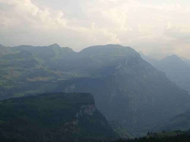
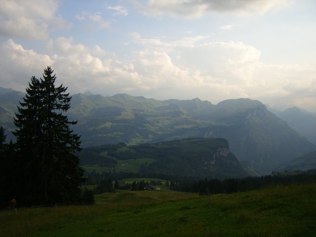
A couple of pictures taken with my cell phone of the view from just above the village of Schwyz just before starting to climb the Ibergeregg Pass.
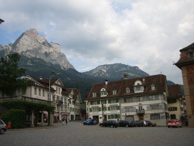
A view of the old town square in the city of Schwyz.
A view from just above the city of Schwyz looking towards the city of Brunnen and the lake of Luzern.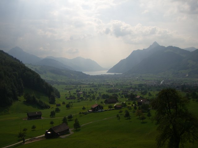
Cycling The Pragel Pass
The Pragel Pass has an altitude of 1550 metres. It can be approached from the western-side from the village of Muotathal or the eastern-side from the village of Glarus. I rode the western, and more difficult climb, via Muotathal; it has some steep sections of 15%-20% grade and is about 12 kms long. It took me about 1.5 hours to climb.
The pass is in part made famous by the Russian General Suvorov who lead his troups over it to perform an amazing escape from the Napoleanic army. The road is unique is some ways because it is a quiet country road that is closed to traffic on the weekends.
The village of Muotathal is at the end of the Muota valley and the ride from the village of Schwyz to Muotathal is a pleasant 1/2 hr ride up a slight grade and along the Muota river. The day I road it I saw a group of people white-water rafting it. The road also passes by an impressive funicular that goes up from the valley to the ski village of Stoos. I stopped by the funicular and looked up at the tracks kind of amazed at how it disappears up the side of the mountain.
The town of Muotathal itself is famous in Switzerland for their 'Weather Frogs'. Weather frog is name for the local inhabitants that make weather predictions; I believe it is kind of like the Farmer's Almanac we have back in Canada. My wife seems to believe in their abilities.
The Muotathal side of the pass is quite rural. It winds up via a narrow valley, that is steep in several places (15% grade) and past several little farms where one can buy cheese. They looked a little too local for me and I was a bit too shy to actually try my hand at buying some cheese. Maybe next time I will get up some nerve to knock a farmers door and use my broken German to buy some cheese.
As far as places to eat on the way up I only remember seeing a place just outside of the village of Muotathal before the 'true' climb began as the road headed into the woods and an Alpenwirtschaft (a farm based restaurant) not far from the top. If you have not eaten at one of these little farm based restaurants then it is an interesting cultural experience that I would recommend to anyone new to Switzerland.
The Glarus side of the pass seemd more populated and had a couple of hotels. This section of the ride seemed more like a Canadian national park than the usual rural Swiss farmland. There was a beautiful alpine lake, the lake of Klöntal, about 1/3 of the way down the mountian. I was quite amazed to come across it. I found an excellent set of photos of the Klöntal area on the web.
Even though it had a beach and a campground on it's shores it seem quite peaceful. The ride along the lakeshore was about 4 kms long and is very pleasant. Even though I say this part of the ride was not the usual rural Swiss farmland I still had to stop at one point as a farmer moved his cows across the road from one pasture to another.
After the lake of Klöntal the decent began again. The road decended through the woods following the river/creek from the dammed lake. At several points along the creek there were walking bridges and what looked to be some very nice hiking trails. I think this would be a good spot to visit again on foot.
I arrived in Glarus about 4 hours having after left Walchwil. I had a bite to eat from the Kiosk store at the tain station. It was my first time in the city of Glarus which is located in a long valley with high mountains on either side. To the northeast is where the train goes to exit the valley and to southwest is the Klausen pass where the train line ends before the climb to the pass begins.
An interesting fact about the ride was that it took about 4 hrs to do by bike and then the return trip by train took about 1 1/2 hrs. The bike ride was not much longer than the train trip because the train had to go around the same mountains I had just ridden over with my bike.