Moving this blog to bikeswitzerland.blogspot.com
http://bikeswitzerland.blogspot.com/
I'm looking forward to a good summer of biking. I've set aside a good chunk of time for some bike touring around the alps. I expect one of my friends to be coming over from Canada to join me for at least one of the trips.
~Tony
Summary of passes I have ridden
- Susten
- Klausen
- Pragel
- Oberalp
- Furka
- Lukmannia
- Grosse Scheidegg
- Ibergeregg
- San Bernadino
- Splugen
- Maloja
- Chasseral
Cycling Grosse Scheidegg and Susten Pass

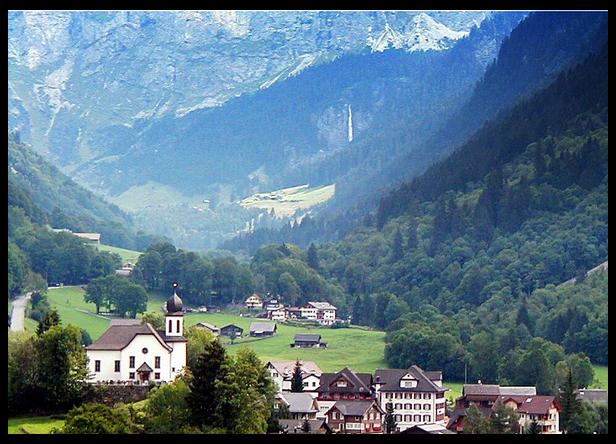
This ride was done on May 26th 2007. It covered two of Switzerland's high alpine passes. It started in the town of Wassen, went up over the Susten Pass, down into the town of Innertkirchen, up over the Grosse Scheidegg Pass, and finished with a decent into the town of Grindelwald. The above picture is from Grosse Scheidegg looking down towards Grindelwald.
I had ridden the Susten a few times before, but this was my first time riding the Grosse Scheidegg pass. I was looking forward to exploring the Scheidegg based upon some of what I had read about the road.
- Map of Route
- Profile of the Susten, 2224m high, 1308m elevation gain, 17.4km long
- Profile of the Grosse Scheidegg, 1962m high, 1262m elevation gain, 16.4 km long
It rained lightly for my first hour of riding, but leg warmers, arm warmers, and a light cycling jacket were enough to get me through it. I did manage to catch a cold, so a cycling vest would have been a nice extra.
This was the earliest I had ever ridden the Susten Pass. The pass was closed just the week before, and up near the top there was still more than a meter of snow at the sides of the road. The Scheidegg pass, which is a few hundred meters lower than the Susten, didn't have any snow along the road.
I won't write much about the Susten pass here since I've written about it in other blog entries. What is interesting is to compare some of the photos from this trip, done in the late spring, with the photos from another trip done in the high summer.

The above picture was taken near the Susten pass, just before entering the short tunnel to the pass summit. Check out that snow bank with my bike leaning against it.
The above picture is of the restuarant at the Susten Pass summit.
It is 27 kilometers of downhill from the Susten pass to the village of Innertkirchen. Wow, take a look at that Swiss road engineering. I am finally learning to take off my sunglasses before the tunnels.
A view of the village of Meiringen from the early part of the Grosse Scheidegg road near the top of the Reichenbach falls. Remember this picture was taken on the same day as those snowy pictures from the Susten pass. It is looking quite sunny and green.

A cool little restaurant near the top of the Reichenbach falls. This place rents some little go-karts that you can use to coast down the hill.

A park map on a plateau about half way up the climb to Grosse Scheidegg. If you look closely you can see some description of the animals that can be found in the park. At this point I was still thinking the climb was going to be a piece of cake. But wait the steep part is still to come.
A picture of the famous Rosenlaui hotel which is found a bit more than half way up the climb to the Grosse Scheidegg. It is a few kilometers before a really steep section of the climb (12+% grade). Unfortunately I didn't take a picture of the steep part. I guess I was too busy breathing and trying to muscle my legs over my pedals :-)

A little rest spot just after the very steep section of the climb, and just before the final few kilometers to the top; the road to the top winds off to the left of the picture. Don't worry there are still a couple of 10+% grades on the way to top. At this point I was starting to think the climb was worth its 148 difficulty rating.

The restaurant at the Grosse Scheidegg pass.
It is all downhill to Grindelwald from here. If you click on the picture you can see the village of Grindelwald down in the valley and on the far side of the valley is the Kleiner Scheidegg just below the north face of the Eiger Mountain.
Cycling The Ibergeregg Pass
This ride took place on August 8th 2006. The weather was overcast and a short heavy downpour started as just I got on the train to head back home.
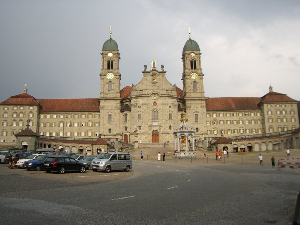
The picture below is of the Monastary in Einsiedeln.
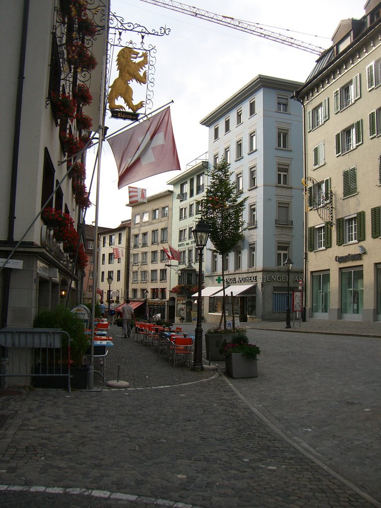
With my back facing the monastary the picture below is one of the streets of the old town.
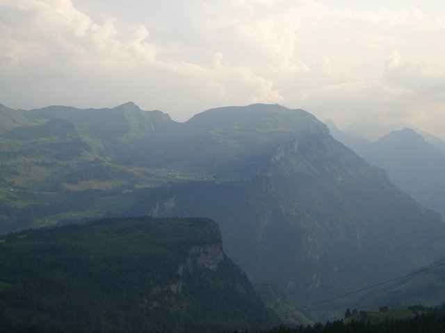
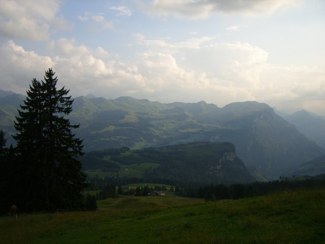
A couple of pictures taken with my cell phone of the view from just above the village of Schwyz just before starting to climb the Ibergeregg Pass.
A view of the old town square in the city of Schwyz.
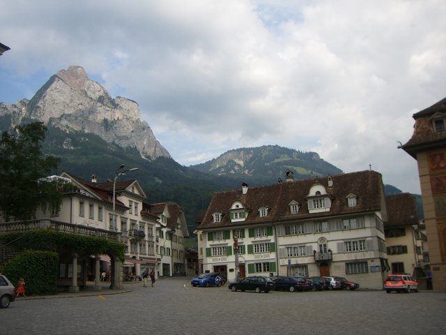
A view from just above the city of Schwyz looking towards the city of Brunnen and the lake of Luzern.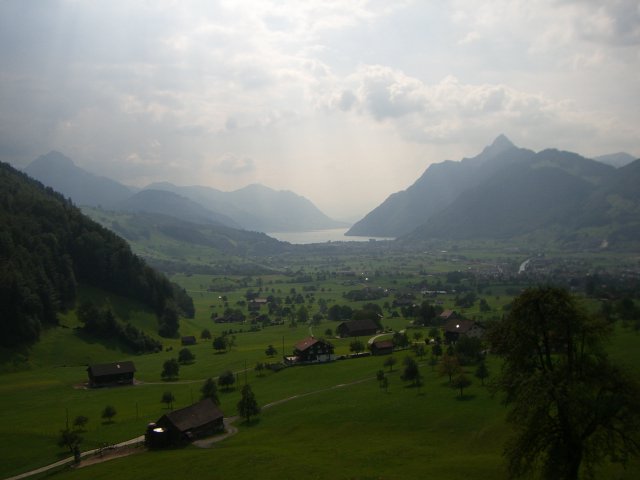
Cycling The Pragel Pass
The Pragel Pass has an altitude of 1550 metres. It can be approached from the western-side from the village of Muotathal or the eastern-side from the village of Glarus. I rode the western, and more difficult climb, via Muotathal; it has some steep sections of 15%-20% grade and is about 12 kms long. It took me about 1.5 hours to climb.
The pass is in part made famous by the Russian General Suvorov who lead his troups over it to perform an amazing escape from the Napoleanic army. The road is unique is some ways because it is a quiet country road that is closed to traffic on the weekends.
The village of Muotathal is at the end of the Muota valley and the ride from the village of Schwyz to Muotathal is a pleasant 1/2 hr ride up a slight grade and along the Muota river. The day I road it I saw a group of people white-water rafting it. The road also passes by an impressive funicular that goes up from the valley to the ski village of Stoos. I stopped by the funicular and looked up at the tracks kind of amazed at how it disappears up the side of the mountain.
The town of Muotathal itself is famous in Switzerland for their 'Weather Frogs'. Weather frog is name for the local inhabitants that make weather predictions; I believe it is kind of like the Farmer's Almanac we have back in Canada. My wife seems to believe in their abilities.
The Muotathal side of the pass is quite rural. It winds up via a narrow valley, that is steep in several places (15% grade) and past several little farms where one can buy cheese. They looked a little too local for me and I was a bit too shy to actually try my hand at buying some cheese. Maybe next time I will get up some nerve to knock a farmers door and use my broken German to buy some cheese.
As far as places to eat on the way up I only remember seeing a place just outside of the village of Muotathal before the 'true' climb began as the road headed into the woods and an Alpenwirtschaft (a farm based restaurant) not far from the top. If you have not eaten at one of these little farm based restaurants then it is an interesting cultural experience that I would recommend to anyone new to Switzerland.
The Glarus side of the pass seemd more populated and had a couple of hotels. This section of the ride seemed more like a Canadian national park than the usual rural Swiss farmland. There was a beautiful alpine lake, the lake of Klöntal, about 1/3 of the way down the mountian. I was quite amazed to come across it. I found an excellent set of photos of the Klöntal area on the web.
Even though it had a beach and a campground on it's shores it seem quite peaceful. The ride along the lakeshore was about 4 kms long and is very pleasant. Even though I say this part of the ride was not the usual rural Swiss farmland I still had to stop at one point as a farmer moved his cows across the road from one pasture to another.
After the lake of Klöntal the decent began again. The road decended through the woods following the river/creek from the dammed lake. At several points along the creek there were walking bridges and what looked to be some very nice hiking trails. I think this would be a good spot to visit again on foot.
I arrived in Glarus about 4 hours having after left Walchwil. I had a bite to eat from the Kiosk store at the tain station. It was my first time in the city of Glarus which is located in a long valley with high mountains on either side. To the northeast is where the train goes to exit the valley and to southwest is the Klausen pass where the train line ends before the climb to the pass begins.
An interesting fact about the ride was that it took about 4 hrs to do by bike and then the return trip by train took about 1 1/2 hrs. The bike ride was not much longer than the train trip because the train had to go around the same mountains I had just ridden over with my bike.
Cycling The Susten Pass
This ride was done on Friday July 21st 2006. The weather was hot and sunny.
- Susten route map
- Susten Pass profile
- Innertkirchen webcams - camera1, camera2, camera3
The Susten Pass has an altitude of 2224m and can be approached from the eastern side from the town of Wassen or the western side from the town of Innertkirchen. The eastern and western approaches are approximately the same difficultly with the eastern one being a bit longer but flatter.
My wife - Gabrielle - and I took the eastern approach riding from the village of Wassen to the village of Meiringen - famous for being the location where Sherlock Holmes died - for a total distance of 53 km. The climb to the top is about 1304 metres high, 17.5 km in length, and took less than 3 hrs. The profile of the climb can be seen here: Susten Pass profile. There are a couple of little restaurants between Wassen and the top, but no real villages.
We started our trip by taking the train from Arth-Goldau to the small alpine village of Göschenen . From there one can catch an alpine train to the higher alpine town of Andermatt. We instead biked about 5 kms downhill to the town of Wassen where the side valley of the Susten pass meets the main valley. The climbs starts right out of the town of Wassen via Sustenstrasse. There is one covered (half-tunnel) section of road a few kilometres up the road that is about 1/2 km long and makes one wonder if it is going to be a good ride. But don't worry, it is.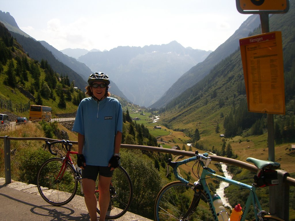
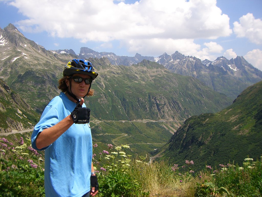
The picture here shows Gabrielle about 1/3 rd of the way up the climb. We pulled over to enjoy the view and a snack. You can see to the left side of the picture one of those orange postal buses headed back down the valley. These buses are all over the place and have the cute little alpine horn that they sound on some of the sharp mountain switchbacks. Below is a photo looking up the valley from the same location.
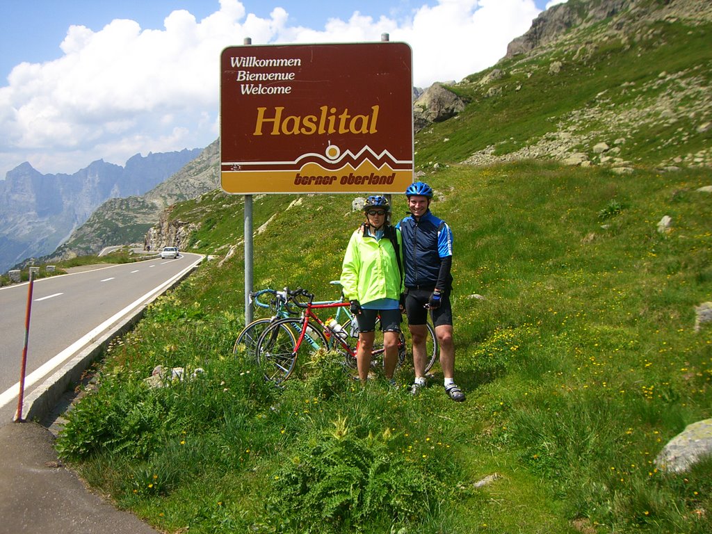
Below is a picture from the restaurant at the pass looking down the other side towards Meiringen. Take note of the little brown sign just before the road heads down. The next picture is of us standing beside that sign.
From here it is all downhill. We took almost an hour to wind our way to the bottom of the hill. As a male in my 40s I am a bit ashamed to admit I find these long downhills at speed to be a bit frightening. On this downhill there were a few tunnels where I was still wearing my sunglasses and there was some water on the road. My wife seems to handle the downhilss better than me. We must of made some respectable speed because we did manage to overtake another cyclist and to keep up with some cars from time to time.
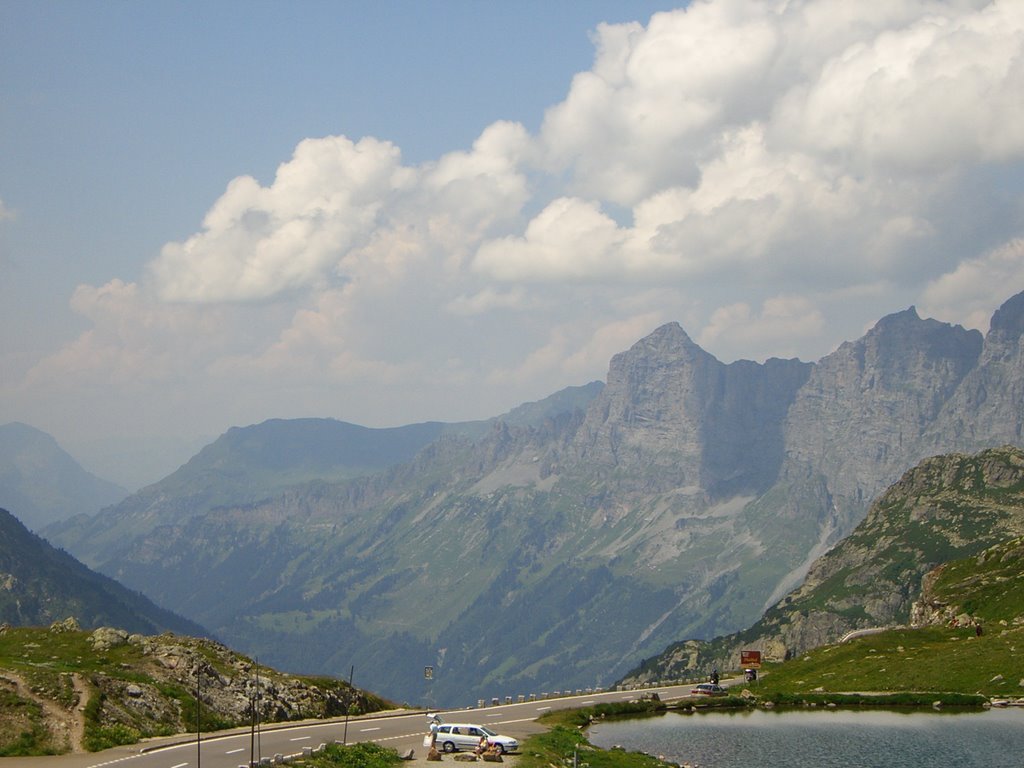
Here is a picture of a very neat looking glacier and alpine lake that we passed by on our way down the mountain. The picture sure does make it look small. If you look closely on the road to the right you will be able to see a tiny little car.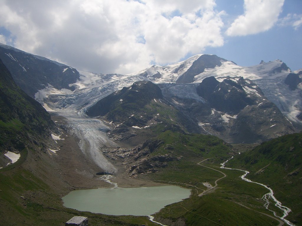
At the bottom of the hill is the little town of Innertkirchen. If one wanted they could head south up the Grimsel Pass towards Italy or continue towards Meiringen and meet up with the road west to Grindelwald that goes over the Grosse Scheidegg pass.
On the road into Meiringen it was mostly flat and busy traffic, but there was one short steep 90 metre climb just to make you work at the end of the ride. We stopped there for about an hour and had something to eat and drink before catching a train to Luzern.
Cycling The Klausen Pass
 This ride was done on Friday July 14th, 2006. The weather was hot and sunny.
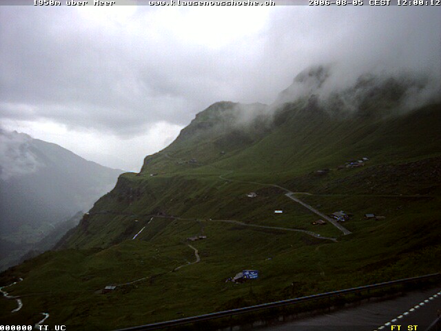
I hope to come back to this blog and sprinkle in some photos, but for the time being I've posted a web cam picture from another day.
The Klausen Pass has an elevation of 1950 metres. It can be approached from the east via the village of Linthal or from the west via the village of Altdorf. I took the train to Altdorf and started my climb from there. The ride went from Altdorf to Glarus, a distance of approximately 63 km with the climb occupying about 24kms it. The climb took me just over 2 hrs.
The ride first passes through the villages of Altdorf and Burglen. Burglen's claim to fame is that it was the home of William Tell. He's the character that was supposedly forced, by an Austrian reeve, to shoot an apple from the head of his son. The story goes he later shot the reeve and sparked a rebellion that lead to the formation of the Swiss Confederacy. This was around 1307. The Swiss Charter was signed in 1291. You'll have to investigate the timeline yourself to figure out what filled the gap :-)
The profile of the climb is shown here: Klausen Pass profile. It is a pretty steady uphill grade - no standing was necessary - with no really steep sections. There is one downhill in the middle of it into the village of Unterschachen. It can be seen on the swiss maps website here and below is a photo.
above photo taken from http://www.varp.net/
One thing that makes the climb less daugnting is that like most Swiss passes there is a little restaurant at the top of the pass where you can eat some well earned bratwurst and drink some apfelsaft before starting the long decent. That's one thing that biking in Switzerland has over some of the biking in North America; food and drink is always nearby.
The route up climbs through several small towns during the first 16kms and then moves up into a more rocky, remote looking alpine territory nearer the top. The last 4 or 5 km of the road are pretty impressive and are built into a cliffside; the views are very good along here. I personally didn't look over the edge very much while biking because I sometimes have a little thing about heights.
Just before the top I rested at a lookout, squeezed a 'clif-shot' into my mouth, and chased it down with some water, while looking back at a spectular valley view. There was a little restaurant hotel there, The Klausen Pass Hoehe, and a bus of tourists had also stopped to enjoy the view. Nothing against the bus tourists - it is a beautiful way to see the country too - but I doubt they shared my feelings of accomplishment. It's surprising to look back at these long mountain valley climbs and think 'gosh I climbed that on my bike'. Once again, here is a link to the Klausen Pass webcam.
At the very top of the pass, about 1 km further up the hill, there is again another little restuarant and a parking lot before the decent starts. The side of the mountain heading into Linthal has many more switchbacks than the uphill portion of the ride. It has a few flat sections along the way and some of these sections have some little restaurants too. Closer to the bottom of the ride some of the switchback turns are made with small cobblestone. Fortunately I am a slow descender, so the cobblestones don't bother me much.
It was hot on the way up, but as I got higher the temperature dropped to a comfortable biking temperature. At the top of the pass there was enough of a cool wind that I put on a cycling vest before the decent. On the way down the mountain my ears popped and the temperature increased to hot. I pulled over to give my hands a rest from squeezing the brakes, to enjoy the views, and take off my cycling vest.
At the bottom of the moutain is the town of Linthal, from there it was still about another hour of riding to Glarus. At about 14kms out of Glarus I got a flat while biking on a path paved with fine gravel because my tire casings were wearing out. Given the state of my tires, I decided to take the normal roads into Glarus to avoid another puncture.
I arrived in Glarus, a map of which is here, about 2 hrs after having reached the mountain pass. The town boasts of being the smallest Canton - state - capital in Switzerland. It was my second time being there; the first was during a ride of the Pragel pass. You can see more pictures of it on their website http://www.stadt-glarus.ch/ or the Glarus Webcam .
In all the trip took about 8 hours round-trip from Walchwil counting train travel and transfer waits.