Cycling The Susten Pass
This ride was done on Friday July 21st 2006. The weather was hot and sunny.
- Susten route map
- Susten Pass profile
- Innertkirchen webcams - camera1, camera2, camera3
The Susten Pass has an altitude of 2224m and can be approached from the eastern side from the town of Wassen or the western side from the town of Innertkirchen. The eastern and western approaches are approximately the same difficultly with the eastern one being a bit longer but flatter.
My wife - Gabrielle - and I took the eastern approach riding from the village of Wassen to the village of Meiringen - famous for being the location where Sherlock Holmes died - for a total distance of 53 km. The climb to the top is about 1304 metres high, 17.5 km in length, and took less than 3 hrs. The profile of the climb can be seen here: Susten Pass profile. There are a couple of little restaurants between Wassen and the top, but no real villages.
We started our trip by taking the train from Arth-Goldau to the small alpine village of Göschenen . From there one can catch an alpine train to the higher alpine town of Andermatt. We instead biked about 5 kms downhill to the town of Wassen where the side valley of the Susten pass meets the main valley. The climbs starts right out of the town of Wassen via Sustenstrasse. There is one covered (half-tunnel) section of road a few kilometres up the road that is about 1/2 km long and makes one wonder if it is going to be a good ride. But don't worry, it is.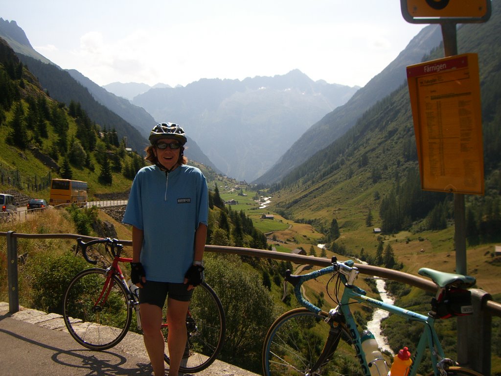
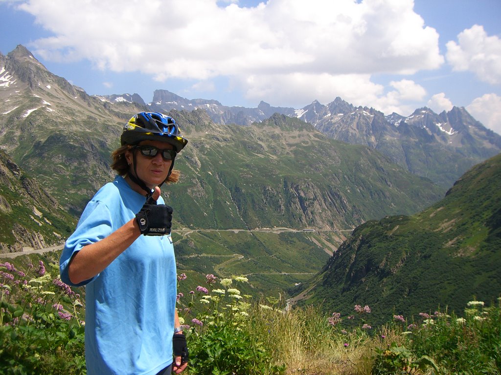
The picture here shows Gabrielle about 1/3 rd of the way up the climb. We pulled over to enjoy the view and a snack. You can see to the left side of the picture one of those orange postal buses headed back down the valley. These buses are all over the place and have the cute little alpine horn that they sound on some of the sharp mountain switchbacks. Below is a photo looking up the valley from the same location.
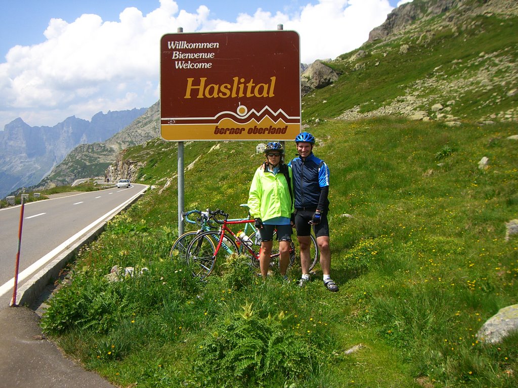
Below is a picture from the restaurant at the pass looking down the other side towards Meiringen. Take note of the little brown sign just before the road heads down. The next picture is of us standing beside that sign.
From here it is all downhill. We took almost an hour to wind our way to the bottom of the hill. As a male in my 40s I am a bit ashamed to admit I find these long downhills at speed to be a bit frightening. On this downhill there were a few tunnels where I was still wearing my sunglasses and there was some water on the road. My wife seems to handle the downhilss better than me. We must of made some respectable speed because we did manage to overtake another cyclist and to keep up with some cars from time to time.
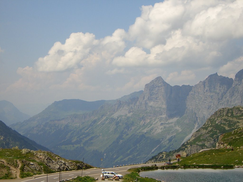
Here is a picture of a very neat looking glacier and alpine lake that we passed by on our way down the mountain. The picture sure does make it look small. If you look closely on the road to the right you will be able to see a tiny little car.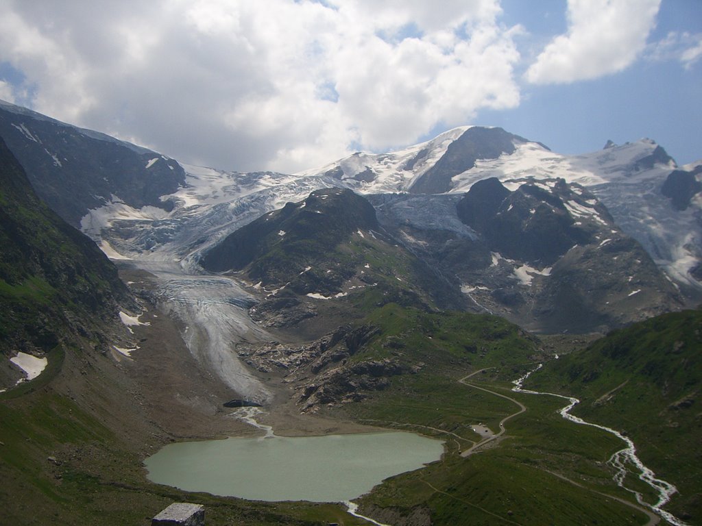
At the bottom of the hill is the little town of Innertkirchen. If one wanted they could head south up the Grimsel Pass towards Italy or continue towards Meiringen and meet up with the road west to Grindelwald that goes over the Grosse Scheidegg pass.
On the road into Meiringen it was mostly flat and busy traffic, but there was one short steep 90 metre climb just to make you work at the end of the ride. We stopped there for about an hour and had something to eat and drink before catching a train to Luzern.
Cycling The Klausen Pass
 This ride was done on Friday July 14th, 2006. The weather was hot and sunny.
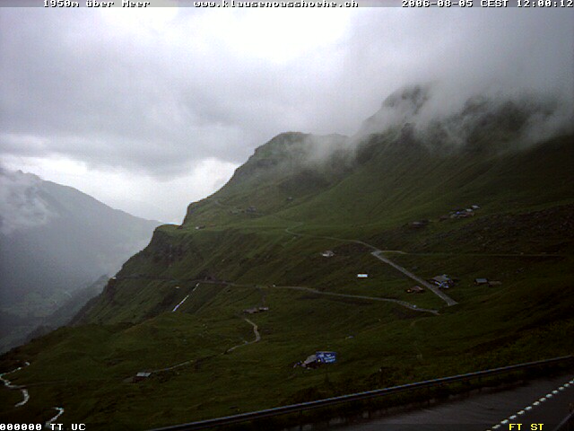
I hope to come back to this blog and sprinkle in some photos, but for the time being I've posted a web cam picture from another day.
The Klausen Pass has an elevation of 1950 metres. It can be approached from the east via the village of Linthal or from the west via the village of Altdorf. I took the train to Altdorf and started my climb from there. The ride went from Altdorf to Glarus, a distance of approximately 63 km with the climb occupying about 24kms it. The climb took me just over 2 hrs.
The ride first passes through the villages of Altdorf and Burglen. Burglen's claim to fame is that it was the home of William Tell. He's the character that was supposedly forced, by an Austrian reeve, to shoot an apple from the head of his son. The story goes he later shot the reeve and sparked a rebellion that lead to the formation of the Swiss Confederacy. This was around 1307. The Swiss Charter was signed in 1291. You'll have to investigate the timeline yourself to figure out what filled the gap :-)
The profile of the climb is shown here: Klausen Pass profile. It is a pretty steady uphill grade - no standing was necessary - with no really steep sections. There is one downhill in the middle of it into the village of Unterschachen. It can be seen on the swiss maps website here and below is a photo.
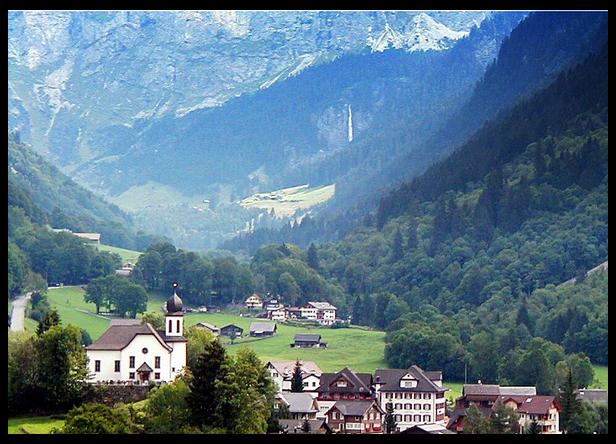
above photo taken from http://www.varp.net/
One thing that makes the climb less daugnting is that like most Swiss passes there is a little restaurant at the top of the pass where you can eat some well earned bratwurst and drink some apfelsaft before starting the long decent. That's one thing that biking in Switzerland has over some of the biking in North America; food and drink is always nearby.
The route up climbs through several small towns during the first 16kms and then moves up into a more rocky, remote looking alpine territory nearer the top. The last 4 or 5 km of the road are pretty impressive and are built into a cliffside; the views are very good along here. I personally didn't look over the edge very much while biking because I sometimes have a little thing about heights.
Just before the top I rested at a lookout, squeezed a 'clif-shot' into my mouth, and chased it down with some water, while looking back at a spectular valley view. There was a little restaurant hotel there, The Klausen Pass Hoehe, and a bus of tourists had also stopped to enjoy the view. Nothing against the bus tourists - it is a beautiful way to see the country too - but I doubt they shared my feelings of accomplishment. It's surprising to look back at these long mountain valley climbs and think 'gosh I climbed that on my bike'. Once again, here is a link to the Klausen Pass webcam.
At the very top of the pass, about 1 km further up the hill, there is again another little restuarant and a parking lot before the decent starts. The side of the mountain heading into Linthal has many more switchbacks than the uphill portion of the ride. It has a few flat sections along the way and some of these sections have some little restaurants too. Closer to the bottom of the ride some of the switchback turns are made with small cobblestone. Fortunately I am a slow descender, so the cobblestones don't bother me much.
It was hot on the way up, but as I got higher the temperature dropped to a comfortable biking temperature. At the top of the pass there was enough of a cool wind that I put on a cycling vest before the decent. On the way down the mountain my ears popped and the temperature increased to hot. I pulled over to give my hands a rest from squeezing the brakes, to enjoy the views, and take off my cycling vest.
At the bottom of the moutain is the town of Linthal, from there it was still about another hour of riding to Glarus. At about 14kms out of Glarus I got a flat while biking on a path paved with fine gravel because my tire casings were wearing out. Given the state of my tires, I decided to take the normal roads into Glarus to avoid another puncture.
I arrived in Glarus, a map of which is here, about 2 hrs after having reached the mountain pass. The town boasts of being the smallest Canton - state - capital in Switzerland. It was my second time being there; the first was during a ride of the Pragel pass. You can see more pictures of it on their website http://www.stadt-glarus.ch/ or the Glarus Webcam .
In all the trip took about 8 hours round-trip from Walchwil counting train travel and transfer waits.
Look at me: Ain't my life interesting?
 I figure I must have as much to say about the world from here in Switzerland as my blogging friends back in North America. I eat, drink, and sleep just like everybody else. How could that fail to make good reading? Without much ado let's begin.
One of the themes for me this summer is to explore all the nearby Swiss Alpine passes by road bike. There is a whole wack of them right nearby our place. They are big, beautiful, and nasty climbs. It is some of the most beautiful mountain road biking in the world. So why not chronicle the rides?
For those of you that use the Google Earth program here is a link that will show you all the passes:
Google Earth File ... Alpine Passes Near Zug.
The list of mountain passes, with height and difficulty rating, that I plan to ride this Summer are:
- Pragel 1000m, 134.68d
- Klausen 1500m, 137.73d
- Susten 1304m, 135.19d
- Furka 893m, 102.29d
- Grimsel 1540m, 142.35d
- Gotthard 610m, 73.02d
- Oberalp 942m, 96.39d
- Lukmannia 1386m, d 113.44d
The 'd' number beside each pass is a difficulty rating based upon the height and the steepness of the climb. For example the Alpe D'Huez, one of the famous climbs from the Tour de France is 1091 metres and 124.81d. The Col de la Madeleine, another famous Tour de France climb, is 1553 metres and 158.92d.
I'll try to take a camera with me on the rides so I can post some pictures.