Cycling The Susten Pass
This ride was done on Friday July 21st 2006. The weather was hot and sunny.
- Susten route map
- Susten Pass profile
- Innertkirchen webcams - camera1, camera2, camera3
The Susten Pass has an altitude of 2224m and can be approached from the eastern side from the town of Wassen or the western side from the town of Innertkirchen. The eastern and western approaches are approximately the same difficultly with the eastern one being a bit longer but flatter.
My wife - Gabrielle - and I took the eastern approach riding from the village of Wassen to the village of Meiringen - famous for being the location where Sherlock Holmes died - for a total distance of 53 km. The climb to the top is about 1304 metres high, 17.5 km in length, and took less than 3 hrs. The profile of the climb can be seen here: Susten Pass profile. There are a couple of little restaurants between Wassen and the top, but no real villages.
We started our trip by taking the train from Arth-Goldau to the small alpine village of Göschenen . From there one can catch an alpine train to the higher alpine town of Andermatt. We instead biked about 5 kms downhill to the town of Wassen where the side valley of the Susten pass meets the main valley. The climbs starts right out of the town of Wassen via Sustenstrasse. There is one covered (half-tunnel) section of road a few kilometres up the road that is about 1/2 km long and makes one wonder if it is going to be a good ride. But don't worry, it is.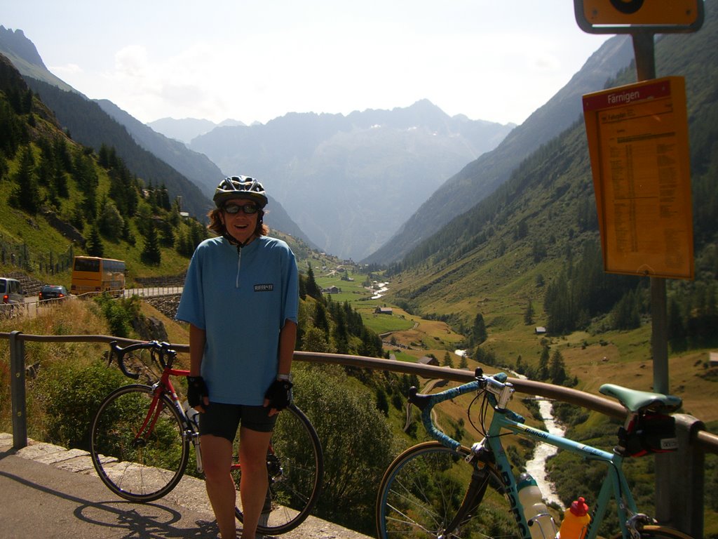
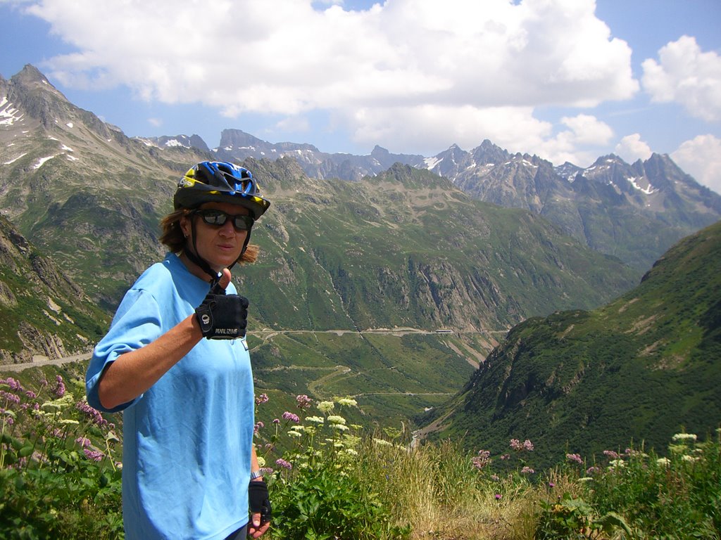
The picture here shows Gabrielle about 1/3 rd of the way up the climb. We pulled over to enjoy the view and a snack. You can see to the left side of the picture one of those orange postal buses headed back down the valley. These buses are all over the place and have the cute little alpine horn that they sound on some of the sharp mountain switchbacks. Below is a photo looking up the valley from the same location.
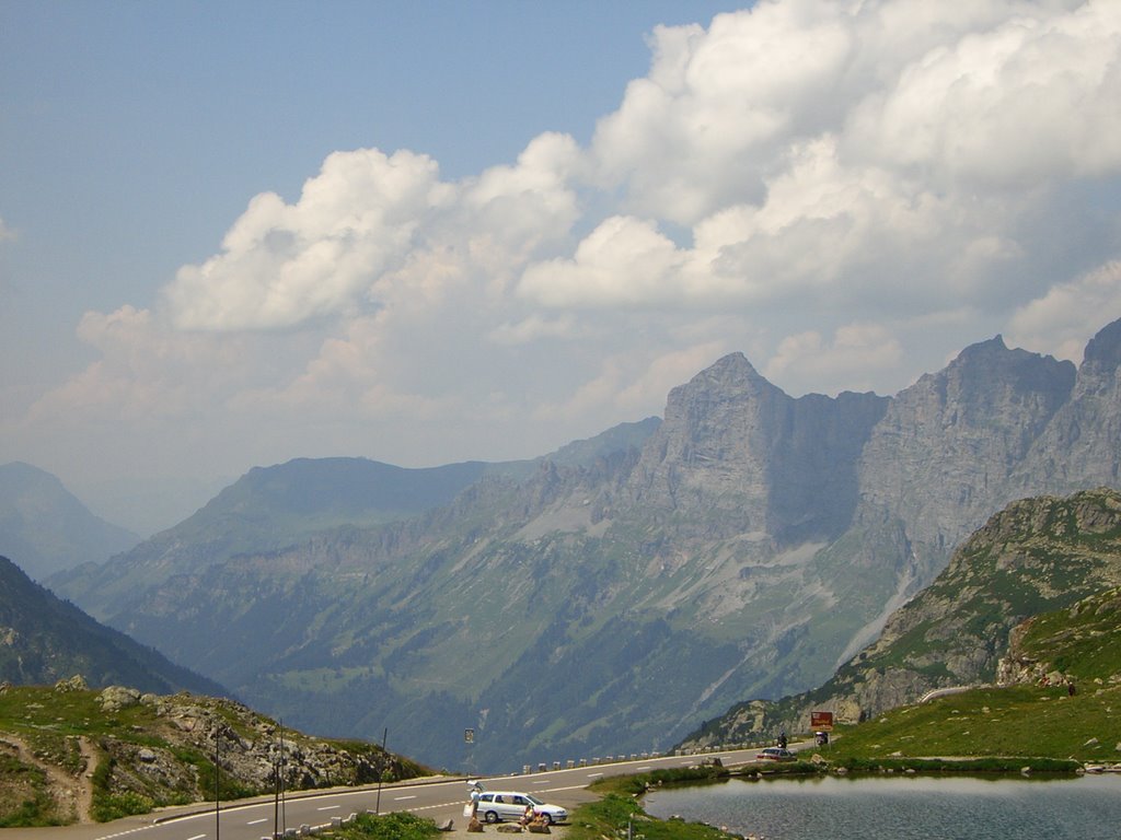
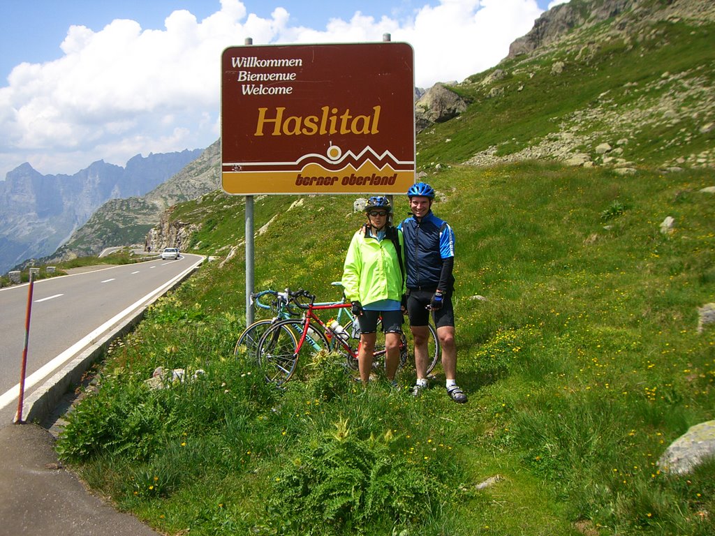
Below is a picture from the restaurant at the pass looking down the other side towards Meiringen. Take note of the little brown sign just before the road heads down. The next picture is of us standing beside that sign.
From here it is all downhill. We took almost an hour to wind our way to the bottom of the hill. As a male in my 40s I am a bit ashamed to admit I find these long downhills at speed to be a bit frightening. On this downhill there were a few tunnels where I was still wearing my sunglasses and there was some water on the road. My wife seems to handle the downhilss better than me. We must of made some respectable speed because we did manage to overtake another cyclist and to keep up with some cars from time to time.
Here is a picture of a very neat looking glacier and alpine lake that we passed by on our way down the mountain. The picture sure does make it look small. If you look closely on the road to the right you will be able to see a tiny little car.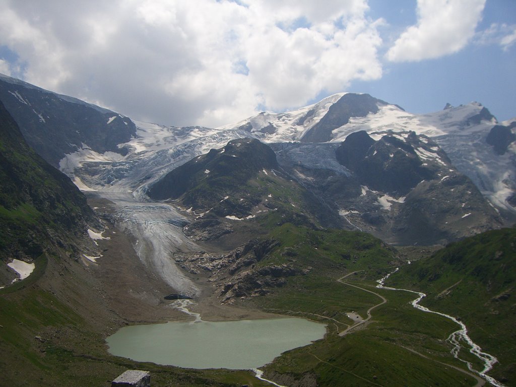
At the bottom of the hill is the little town of Innertkirchen. If one wanted they could head south up the Grimsel Pass towards Italy or continue towards Meiringen and meet up with the road west to Grindelwald that goes over the Grosse Scheidegg pass.
On the road into Meiringen it was mostly flat and busy traffic, but there was one short steep 90 metre climb just to make you work at the end of the ride. We stopped there for about an hour and had something to eat and drink before catching a train to Luzern.
1 comments:
Reichenbach Falls is on the outskirts of Meiringen.